How big is the Reserve?
The Reserve is an 186,189 acre contiguous complex of wetland, terrestrial, and marine environments. It is the third largest Reserve in the National System due to the fact that Texas bay systems are quite large. Typically, the distance between the tidal segment of a river and inlet to the Gulf of Mexico is 15 - 30 miles, which results in Texas bays that are around 50,000 acres.
Is the Reserve site pristine?
The Texas coast is one of the most pristine coasts in the continental United States due to low population density. The Reserve is surrounded by a watershed that is relatively rural, with few large cities or metropolitan areas. The two rivers that flow into the Reserve (the Mission & Aransas rivers) are also some of the few rivers on the Texas coast that do not have dams.
Is the site on private or public land?
The site encompasses State bay waters and State wetlands, which are controlled by the Texas General Land Office. Most of the dry land resides in the Aransas National Wildlife Refuge. The Reserve is comprised of 65% State land and 33% Federal land. Other landowners in the Reserve include The Coastal Bend Bays & Estuaries Program, Fennessey Ranch, Texas Parks and Wildlife Department, Texas Department of Transportation, Aransas County Navigation District, and The University of Texas.
Does the Reserve implement and enforce new rules and regulations?
The Reserve relies on existing rules and regulations from the Coastal Management Program, Texas Parks and Wildlife Department, Texas Commission on Environmental Quality, Texas General Land Office, and Texas Railroad Commission to provide protection for its water and land areas. The landowners in the Reserve maintain control of their property and use existing regulations to manage their property.
|
|
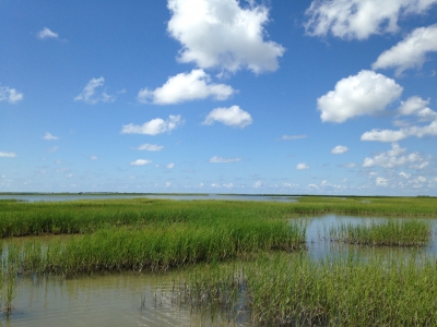
The Mission-Aransas Reserve is a mosaic of different habitats.
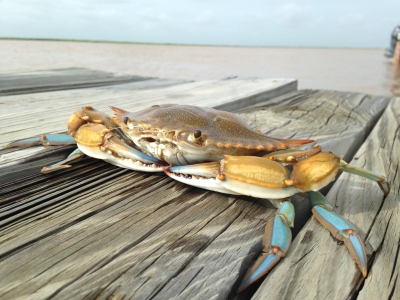
Blue Crabs in the Mission-Aransas Reserve.
|
|